It probably comes as no surprise to hear that you can travel further in less time when travelling by private transport, such as in a car, than by public transport using a bus or a train. However, have you ever wondered what this difference looks like visually for the place where you live or work?
WISERD has now launched an updated version of Understanding Welsh Places that can show you.
Understanding Welsh Places is a website that presents information on the economy, demographic make-up and local services of more than 300 places in Wales with a population of over 1,000 residents. The new version of the website has seen a substantial update to the ‘Connectivity’ section, which offers an overall sense of the ability to travel from each of Wales’ principal places (the 193 places with more than 2,000 residents).
As part of the update, we have released new visualisations that indicate the extent of the area that can be reached from each place when travelling by private transport (car), train, bus, cycling and walking for between 10 and 90 minutes.
These visualisations can be viewed by different periods of the day (morning, midday, evening and night), different periods of the week (weekday, Saturday and Sunday) and, for rail and bus travel, by whether the service is a direct service or whether it requires a change.
For bus travel, we also include a measure to indicate the frequency of service each area receives during that selected period.
As well as producing these visualisations for each of Wales’ principal places, we have also released them for Wales’ railway stations, offering an indication of the area that can be reached from each station in Wales. These can be found in the ‘By rail’ section for each place on the website.
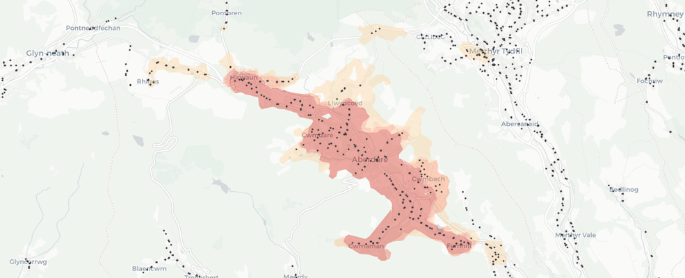
The below example shows the areas that can be reached within 30 minutes when travelling from Aberdare on a weekday morning on direct services by different modes of transport.
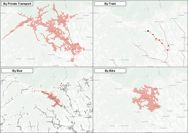
Source: Understanding Welsh Places data
Professor Scott Orford said “The new maps and tools on the Understanding Welsh Places website allows users for the first time to really see how the places where they live and work are connected and to visualise the gaps in public transport provision in their local areas.”