Inequalities, civic loss and well-being uses innovative methods, including app-based surveys of spatial mobility and data linkages, to compare place-based and individual measures of accessibility, and explore how changing patterns of civic loss and gain relate to measures of health and well-being. Start date provided is that of the WISERD Civil Society Centre. Work packages…
Overview The study carried out analysis of existing secondary sources of quantitative data in order to investigate levels of social capital within communities in relation to changing levels of provision of key public services. The study built on research conducted in Phase 1 of WISERD on the use of enhanced two step floating catchment area (E2SFCA) techniques to examine…
This project will focus on the development of interactive dashboards and web-based tools that enable stakeholders to participate in the design and evaluation of transport services. The research will demonstrate how open source technologies can be used to plan public transport networks and investigate the spatial implications of access to medical, social and employment sites….
Drawing on the application of spatial analytical tools (based on floating catchment area (FCA) methods), this commentary highlights some of the challenges faced in promoting the use of geographical techniques to address aspects of government policy/delivery. There is an ever-expanding academic literature concerned with the application of FCA techniques in a range of thematic areas,…
Accessing the most appropriate forms of care in the right places and at the right time is a primary concern for people receiving care and their families. The residential and nursing care home sector is faced with numerous deep-seated problems, many of which have been exacerbated by the impacts of the COVID-19 pandemic and the…
An intuitive and interactive open-source web tool for measuring access to services via public transport is described. The application allows policymakers to analyse and compare the impacts that alternative network configurations may have upon access to services. The application facilitates interactive analyses to support decision-makers in making better informed choices. The study addresses key technical…
Scheduled timetable information has been used extensively in studies concerned with estimating travel times in accessibility research. Fewer studies to date have involved the use of real-time public transport data to help investigate the impacts of travel disruptions or cancellations of service on reported spatial and temporal patterns of accessibility. The aims of this paper…
It is estimated that over half a million people visited one network of ‘warm rooms’ during the winter of 2022 in the UK, a figure that may rise to 2.5 million people if other networks are considered. As well as offering a means to try to limit exposure to cold temperatures and reduce household energy costs,…
The paper draws upon open-source technologies to present methods of incorporating multiple travel modes into GIS analyses of cumulative opportunity and proximity-based metrics of accessibility. Two case studies are undertaken. The first uses isochrone analysis to evaluate national access to sport facilities expected to appeal to a broad range of ages and abilities. Predictably, urban…
Introduction Events surrounding the COVID-19 pandemic drew attention to the importance of local neighbourhoods as people were encouraged wherever possible to work from home, the physical and mental health benefits of active means of travel were promoted, and communities became more reliant on services in their local areas. At the same time governments around the…
There is a longstanding policy interest in understanding the impacts of changes in access to public and private services in rural areas. To date much of the empirical analysis concerning changing patterns of accessibility has been predicated on assumptions regarding the mode of transport used to access such facilities. The availability of new and open…
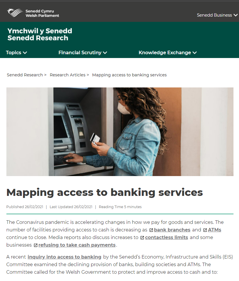
The UK, as elsewhere, has seen an accelerating trend of bank branch closures and reduced opening hours since the early 2000s. The reasons given by the banks are well rehearsed, but the impact assessments they provide to justify such programs and signpost alternatives have been widely criticized as being inadequate. This is particularly so for…
Academics at the University of South Wales, affiliated to WISERD, have looked at how the pandemic has affected bus service levels across Wales. Their guest article details how the most deprived areas – where people most depend on bus services – have been hardest hit.
Suggestions of the existence of so-called ‘social care deserts’ in England in the years leading up to the COVID-19 pandemic drew attention to the potential impact of geographical inequalities on the availability of residential, nursing and domiciliary care. To date, much of this analysis has been conducted at spatially aggregated scales such as that of…
Applied Spatial Analysis and Policy: Contemporary Applications for Spatially Integrated Social Science 14(3) pp 449-472 In response to changing consumer habits driven by the advance of online services and mobile apps, substantial reductions in the provision of bank branches have been widely documented over the last decade. Such closures have economic consequences for the sustainability of…
Journal of Civil Society 17(2) pp 101-118 This study explored the respective importance of compositional (individual) and contextual (neighbourhood) factors associated with the propensity to engage in formal volunteering among a nationally representative sample of adults in Wales, UK. To date, while certain contextual characteristics of local communities have been found to be associated with the…
Transactions in GIS, 25(4) pp 1849-1867 This study describes the design and implementation of a web‐based infrastructure built on open‐source components to enable the computation of accessibility scores. It can be adapted to any form of service provision that is represented as geo‐located points. The solution aims to extend previous attempts to measure and analyse…
Under Senedd Research’s Academic Fellowship Scheme, Associate Professor Mitchel Langford from the University of South Wales explored how the latest digital mapping technologies can lead to a better understanding of the geographical provision of retail banking. The full report Exploring geographical patterns in the changing landscape of retail banking services in Wales (PDF, 3.09 MB) is published as a Wales Institute…
Over the past decade successive rounds of bank closures and increasing trends towards fee charging ATMs have attracted widespread media and political attention. This report explores how the latest developments in spatial analytical techniques can provide detailed insight into patterns of provision and change. These techniques are used to provide estimates of accessibility at local community…
Presented by the authors at GIS Research UK Conference 2020 This paper draws on a new database of gymnastics facilities, the use of Two-Step Floating Catchment Area (E2SFCA) techniques, to measure potential accessibility for both private and public transport networks using a web-based tool to collect the network distances for the transport. Plans to incorporate…
Area 52(2) pp 342-353 This paper demonstrates the applicability of GIS tools for investigating the implications of changes in public service provision following a prolonged period of economic austerity in the UK. Using the example of geographical accessibility to public library service points in Wales, levels of provision are estimated for two cross‐sections in time to…
There are ongoing policy concerns surrounding the difficulty in obtaining timely appointments to primary healthcare services and the potential impact on, for example, attendance at accident and emergency services and potential health outcomes. Using the case study of potential access to primary healthcare services in Wales, Geographic Information System (GIS)‐based tools that permit a consideration…
A “flagship” policy outlined in the current Welsh Government’s 2016 Programme for Government aims to provide 30 hours of free early education and childcare per week to the working parents of three‐ and four‐year‐olds. However, in common with many other countries, there is currently a lack of detail regarding existing levels of childcare provision that can act as…
Spatial variations in rates of registered organ donors have not been studied in the UK at detailed spatial scales despite some evidence of national and regional differences. By drawing on the findings from the existing literature, this study examines associations between small-area variations in rates of new registrants to the UK organ donor register (ODR)…
Studies examining potential social inequities in resource distribution have tended to adopt relatively unsophisticated measures of service supply such as those derived from proximity measures or counts of facilities within given time/distance thresholds. Often such measures do not take into account potential demand for services and the implications this has for understanding socio-spatial patterns in…
Approaches to calculating spatial accessibility within existing indices of multiple deprivation (IMD) methodologies are based on ‘traditional’ accessibility metrics and tend not to adopt more recent methodological enhancements. In particular, the last decade has seen a relatively large body of studies that have applied floating catchment area (FCA) methods that account for both service supply…
Public libraries make an important contribution to the wellbeing of local people often acting as community hubs by reducing the isolation felt by vulnerable members of society through promoting social interaction and supporting the wider needs of local communities. However, access to libraries is threatened in Wales, as elsewhere in the UK, by uncertainty stemming…
Existing approaches investigating access to primary health care tend to use relatively crude measures that compare supply to demand ratios for administrative units or use GIS to calculate straight-line or network distances to the nearest facility. The latter however largely assume access is via private modes of transport. The aim of this paper is to…
Network distance and travel times are two popular methods of measuring potential geographic accessibility and networks are also used in gravity model-based approaches such as floating catchment area (FCA) techniques. Although some research has been conducted to assess the effectiveness of the representation of demand- (population) or supply- (destinations) side characteristics within such models, there…
Methods whereby access to facilities can be captured in order to support national policies geared towards promoting sports participation and help plan the provision of local facilities are urgently needed. Objective measures derived from the use of Geographical Information Systems can be used to gain an understanding of spatial variations in the location and quality…
Two-step floating catchment area (2SFCA) techniques are popular for measuring potential geographical accessibility to health care services. This paper proposes methodological enhancements to increase the sophistication of the 2SFCA methodology by incorporating both public and private transport modes using dedicated network datasets. The proposed model yields separate accessibility scores for each modal group at each…
Previous studies concerned with investigating the relationship between levels of physical activity and aspects of the built environment have often led to inconsistent and mixed findings concerning associations between the availability of recreational or sport facilities and area socio-economic status. Further complications may arise when analysis is conducted separately for access to either publicly available…
Floating catchment area (FCA) models are widely promoted as a technique to measure potential accessibility in a range of health applications. Since their initial formulation in the early 2000s a number of enhancements have been proposed to better measure accessibility. Encouraged by the growing availability of road network data, and a realisation of the inherent…
There has been a longstanding interest in the impacts of socio-spatial variations in accessibility to public and private services in both urban and rural contexts. Previous studies have found that rural communities are often disproportionately impacted in accessibility terms by changes in service configuration. The aim of this study is to examine such claims in…
A relatively large literature base exists on the use of GIS to measure accessibility in transport studies. Often such research efforts have been conducted as part of wider studies of social exclusion to public transport opportunities. This paper aims to explore the use of floating catchment analysis (FCA) techniques to measure access to public transport…
A large body of research has examined relationships between accessibility to green space and a variety of health outcomes with many researchers finding benefits in terms of levels of physical activity and relationships with levels of obesity, mental health, and other health conditions. Such studies often use spatial analytical techniques to examine relationships between distance…
Previous research has drawn attention to the importance of measuring accessibility to public transit services for transport planning and decision-making purposes and to the use of GIS to produce accessibility maps. Existing measures have been criticised for their lack of sophistication and reliance on simple operations such as Euclidean buffering. This article introduces an accessibility…
Planning information pertaining to the potential visual impacts of proposed construction developments is particularly important in the case of wind farm planning, given the high levels of concern amongst members of the public regarding the perceived negative visual impacts of wind turbines on the landscape. Previous research has highlighted the shortcomings associated with traditional visualization…
The importance of public service provision and accessibility in shaping government policies aimed at enhancing social inclusion and ensuring social justice in the UK is well founded. The capabilities of GIS for generating information to address such concerns have facilitated a widespread interest in measuring and analysing accessibility to public services. Previous studies have drawn…
This paper aims to review the state of play of GIS use in measuring accessibility to services drawing on work in areas such as health, public services, transport and environmental justice. The first section describes what is meant by ‘accessibility’ in the context of our research. To date this has predominantly been concerned with measures…
There has been a notable increase in the use of geographic information systems (GIS) in studies of environmental (in)justice in the last two decades. Whilst the potential of such techniques is increasingly being recognised, there remain some key research challenges facing researchers interested in wider notions of environmental justice (EJ). One avenue of research concerns…
Groundbreaking research pioneered in Wales is transforming how childcare provision is understood and delivered across England, as new evidence shows the UK’s most detailed analysis of ‘childcare deserts’ and ‘childcare oases’ is built on methods developed by Wales Institute of Social and Economic Research and Data (WISERD) academics. The researchers at WISERD – a collaboration…
The care home sector is experiencing pressures arising from the fall-out of the COVID-19 pandemic and the impact of Brexit on staff shortages, especially impacting on the registered nursing workforce. This is compounded by longer-term financial pressures and on-going staff recruitment concerns, particularly following the latest proposed changes to immigration policy. The introduction of a…
On 30 November, Professor Mitch Langford, a WISERD co-director based at the University of South Wales (USW), presented WISERD research from the ESRC-funded project, ‘Inequalities, civic loss and well-being’, to the Climate Change, Environment, and Infrastructure Committee at the Senedd. The Senedd’s Areas of Research Interest (ARI) event comprised a series of speed talks made…
A recently published paper by Dr Andrew Price and Professors Gary Higgs and Mitchel Langford at the University of South Wales has drawn attention to geographical variations in access to warm spaces in Wales. Warm spaces provide an opportunity to help households try to minimise the impact of rising energy bills in the winter months…
Our previous studies examining variation in access to sporting facilities in relation to socio-economic patterns in Wales have been predicated on an assumption of private travel as the means of transport. We are now including travel distances and times for alternative modes of transport as part of our accessibility calculations. These are derived from an…
Many congratulations to WISERD Co-director Mitchel Langford who has been successful in the latest Higher Academic Awards appointments Mitchel Langford has been conferred the title of Professor in Spatial Analysis and Geo-informatics at the University of South Wales. Mitch’s research interests include geographical accessibility modelling and geospatial analysis in the fields of healthcare, social inequality…
A new WISERD paper by Andrew Price, Mitchel Langford and Gary Higgs at the University of South Wales has recently been published in the journal, Case Studies on Transport Policy. Using sports facility data from Sport Wales and open-source data on green spaces, the team examine variations in potential access to recreational opportunities by different…
A prototype website has been developed by WISERD researchers based at the GIS Research Centre at the University of South Wales (USW) which examines access to key services in Wales. This is part of an ongoing research programme investigating geographical access to services in Wales. The website allows users to see indicators of accessibility to…
A recent paper by Professor Gary Higgs, Dr Andrew Price and Dr Mitchel Langford of WISERD and the GIS Research Centre published in the Journal of Rural Studies has highlighted the need to consider the transport options available to access services for those dependent on public transport. By drawing on a spatial analysis of the…
A new, open access journal article on measuring accessibility to banking services by Dr Mitchel Langford, Andrew Price and Professor Gary Higgs from the University of South Wales, has been published in the ISPRS International Journal of Geo-Information. The article demonstrates how accessibility can be measured to bank branches by different times of day and…
Public transport was severely impacted during COVID-19 as people’s daily mobility patterns changed. This led to a substantial drop in demand as many workers were instructed to work from home and social distancing measures were introduced on existing services. Department for Transport statistics show a decline from 91 to 26 million passenger journeys on local…
A new WISERD paper draws attention to how geographical approaches can contribute to an understanding of inequalities in access to nursing and residential care places in Wales. This research has been carried out by WISERD co-directors, Professor Gary Higgs and Dr Mitchel Langford, along with WISERD Associate, Professor Mark Llewellyn, Director of the Welsh Institute…
Local authorities in Wales have had to make difficult decisions to close or rationalise a wide range of services in response to changes in the incidence of COVID-19. This has had major impacts for those sectors of the community most dependent on various forms of service provision. Where there have been partial closures involving changes…
Over the past decade successive rounds of bank closures and increasing trends towards the provision of fee charging ATMs have attracted widespread media and political attention. WISERD researcher, Mitchel Langford, an Associate Professor at University of South Wales has published a report on access to banking services as a result of his recent Academic Fellowship…
We have long become accustomed to the concerns expressed in the letter pages of local newspapers or on various online forums from those members of the public forced (if fortunate to have access to a car) to drive greater distances, or to make alternative and more costly arrangements, to access services such as health, educational,…
According to available estimates, residents living in more rural areas of Wales generally need to travel farthest to access a number of key services. Take access to GP surgeries, for instance. A two-way journey by car to a local GP surgery is considered to take, on average, between 10-14 minutes for those living in smaller…
WISERD’s bespoke analytical tools were used in a Welsh Government research project to assess whether the existing supply of childcare in Wales can cope with the increased demand due from a change in Government policy. The research and analysis was conducted by WISERD Co-Director Prof Gary Higgs and Dr Mitchel Langford of the University of…
This workshop will introduce the concepts and provide participants with hands-on experience of using an open source GIS package. We will also explore how socio-economic data from the UK Census of Population can be downloaded and integrated with other open source data sets such as road network data. Speakers: Gary Higgs & Mitch Langford
This website uses cookies to improve your experience while you navigate through the website. Out of these, the cookies that are categorized as necessary are stored on your browser as they are essential for the working of basic functionalities of the website. We also use third-party cookies that help us analyze and understand how you use this website. These cookies will be stored in your browser only with your consent. You also have the option to opt-out of these cookies. But opting out of some of these cookies may affect your browsing experience.
Necessary cookies are absolutely essential for the website to function properly. These cookies ensure basic functionalities and security features of the website, anonymously.
Cookie
Duration
Description
cookielawinfo-checkbox-analytics
11 months
This cookie is set by GDPR Cookie Consent plugin. The cookie is used to store the user consent for the cookies in the category "Analytics".
cookielawinfo-checkbox-functional
11 months
The cookie is set by GDPR cookie consent to record the user consent for the cookies in the category "Functional".
cookielawinfo-checkbox-necessary
11 months
This cookie is set by GDPR Cookie Consent plugin. The cookies is used to store the user consent for the cookies in the category "Necessary".
cookielawinfo-checkbox-others
11 months
This cookie is set by GDPR Cookie Consent plugin. The cookie is used to store the user consent for the cookies in the category "Other.
cookielawinfo-checkbox-performance
11 months
This cookie is set by GDPR Cookie Consent plugin. The cookie is used to store the user consent for the cookies in the category "Performance".
viewed_cookie_policy
11 months
The cookie is set by the GDPR Cookie Consent plugin and is used to store whether or not user has consented to the use of cookies. It does not store any personal data.
Functional cookies help to perform certain functionalities like sharing the content of the website on social media platforms, collect feedbacks, and other third-party features.
Performance cookies are used to understand and analyze the key performance indexes of the website which helps in delivering a better user experience for the visitors.
Analytical cookies are used to understand how visitors interact with the website. These cookies help provide information on metrics the number of visitors, bounce rate, traffic source, etc.
Advertisement cookies are used to provide visitors with relevant ads and marketing campaigns. These cookies track visitors across websites and collect information to provide customized ads.